Tel Kabri › Nineveh » Ancient origins
Articles and Definitions › Contents
- Tel Kabri › Antique Origins
- Nineveh › Antique Origins
Ancient civilizations › Historical and archaeological sites
Tel Kabri › Antique Origins
Definition and Origins

Tel Kabri is an archaeological site in the Western Galilee in northwestern Israel and the location of one of the largest palaces in Canaan in the Middle Bronze Age or "MB" (c. 2,000–1,500 BCE), the period in which Tel Kabri was at the height of its power. The palace belonged to a political entity that is as yet unnamed and is largely unknown.
GEOGRAPHY & EXCAVATIONS
Like many Ancient Near Eastern archaeological sites, much of the Kabri site is located on a tell. A "tell" is a manmade mound composed of layers or strata, each representing the remains of a period of occupation, deposited one on top of the other as settlements rose and fell, and compressed by the weight of centuries, with the most recent layers on top. The strata at Kabri date from the Neolithic period (the deepest strata) to modern times (the strata nearest the surface). It is a relatively low mound extending over a wide area and covered today by avocado groves tended by the local kibbutz, Kibbutz Kabri.
The site has been excavated by archaeologists from time to time since 1956 CE. There were two surveys, five minor excavations, and two major excavations. The first major excavation was conducted from 1986–1993 CE by Aharon Kempinski whose expedition found many of the structures comprising the Middle Bronze Age palace, as well as floor and wall frescoes reflecting the style of far-off Aegean cultures, all as described below.
TEL KABRI HAS MANY STRUCTURES INCLUDING A MIDDLE BRONZE AGE PALACE, AS WELL AS FLOOR AND WALL FRESCOES REFLECTING THE STYLE OF FAR-OFF AEGEAN CULTURES.
The second major excavation began in 2005 CE when Professors Assaf Yasur-Landau of the University of Haifa and Eric H. Cline of The George Washington University reopened excavations of the site, with Professor Andrew Koh of Brandeis becoming Associate Director of the expedition in 2013 CE. The ongoing excavations have provided archaeological evidence of the development of the palace described below and studied the Canaanite society and economy of Kabri and surrounding areas and their relationship to the wider Mediterranean world, particularly the Aegean. The current expedition has found additional Aegean-style wall and floor frescoes, and, in the 2013 and 2015 CE seasons, the expedition uncovered large storage areas and many ceramic storage vessels which represent the oldest wine cellar in the world and the largest in the Ancient Near East.
EARLY HISTORY
Although Kabri saw its heyday in the Middle Bronze Age, the area was inhabited as far back as the Pottery Neolithic period (c. 6,400–4,500 BCE) and the early part of the Chalcolithic period, or Copper Age (c. 4500–3500 BCE). The inhabitants were drawn to Kabri by the waters of its springs, but the Kabri settlements mysteriously disappeared in the later part of the Copper Age.
However, in the Early Bronze Age ("EB"), which began around 3500 BCE, a Canaanite town sprang up on the site of Tel Kabri which likely covered the northern half of the tell. (In ancient times, the region that includes modern Israel and surrounding areas was inhabited by a people called "Canaanites" until they were displaced by Israelites sometime in the Iron Age, under circumstances that are much debated, and their land was called Canaan.) This town disappeared - along with countless others throughout the eastern Mediterranean - around the end of the EB in about 2100 BCE, in a mysterious, unidentified wave of destructive events generally known today as the "Early Bronze Age Collapse."
However, in the Early Bronze Age ("EB"), which began around 3500 BCE, a Canaanite town sprang up on the site of Tel Kabri which likely covered the northern half of the tell. (In ancient times, the region that includes modern Israel and surrounding areas was inhabited by a people called "Canaanites" until they were displaced by Israelites sometime in the Iron Age, under circumstances that are much debated, and their land was called Canaan.) This town disappeared - along with countless others throughout the eastern Mediterranean - around the end of the EB in about 2100 BCE, in a mysterious, unidentified wave of destructive events generally known today as the "Early Bronze Age Collapse."

Tel Kabri location within Israel
THE MIDDLE BRONZE AGE
The Pre-Palatial Period
The site remained uninhabited until early in the first part of the Middle Bronze Age, which is known as "Middle Bronze Age I" or "MB I" (c. 2000–1720 BCE). In the early and middle parts of MBI, Tel Kabri was inhabited once more, as shown by the appearance of new tombs and private houses at the site. During much of MB I, the Kabri settlement appears to have been unfortified.
The Four Palaces
The First Palace. Sometime in the middle to late MB I, Kabri's "first palace" and fortifications were constructed. Construction of the first palace began after residential structures built in MB I were razed and the land was flattened out and covered with a layer of earth and debris. The main structures were two thick parallel stone walls, which the Kabri archaeologists called the "corridor," and a room to its north with a plaster floor. The first palace may have resembled a fortress more than a grand palace (Yasur-Landau et al. 2014, 357).
The Second Palace. Then, at about the time of the transition from MBI to the next period, Middle Bronze Age II or "MB II" (a period which lasted from about 1720 BCE to 1550 or 1500 BCE), Kabri's palace grew larger, becoming what we will call the "second palace." The larger second palace replaced the fortress-like first palace, and the corridor and northern room were filled in. Three rooms were built to the east of the corridor area, and one or possibly two meeting halls were built to the west. A thick barrier of earth was built around the site, helping the rulers secure their authority and likely giving Kabrians a greater sense of safety.
It is believed that around this time, Kabri and the coastal city of Acre were in contention for control of the Western Galilee. This may have been reflected in the construction of the fortress-like first Kabri palace and the great earth wall around the second palace, as well as in the abandonment of smaller sites loyal to Kabri as people moved to Kabri and in the fortification of some of Kabri's outposts - such as nearby Achziv.
The Third Palace. Later on, in the MB II period, the palace was greatly expanded again - to the northeast and south, to create the "third palace." This was a time when Kabri apparently won out over Acre for control of the Western Galilee, and this may be reflected in a change in the focus of the palace. In the new third palace, the emphasis seems to have shifted away from defense and military might to displays of culture and wealth. The third palace incorporated many advanced architectural elements, and was decorated with wall frescoes and floor paintings incorporating Aegean art styles and themes. These changes may have represented an attempt to make Kabri appear to be a player on the international stage.
The Fourth Palace. One final expansion resulted in the "fourth" - and final - palace at Kabri. The fourth palace included a separate two-room building in which plaster-covered stone slabs from the beach called "orthostats" lined the foundations, and the building was called the "Orthostat Building" by the Kabri archaeologists. Most importantly, the fourth palace included the Southern Storage Complex, and, as we have said, perhaps many more rooms to the north and west of the Southern Complex and beneath the roadway. The storage rooms that may lie beneath the Southern Complex probably belong to the third palace.
The fourth palace was larger than any of the previous three, but was not as artistically decorated as the third palace. In fact, the frescoes and other plaster paintings of the third palace appear to have been destroyed. Their fragments were used not as decoration, but as packing material, with the painted sides turned face down to conceal their colours so that they could be used as filler in in with white or plain floors and walls of the fourth palace. It is believed that this change was not the result of Kabri losing contact with the Aegean but more likely the result of a shift in the focus of the Kabrians' international communications to Cyprus at this time. The fourth palace appears to have been expanding in size right up to about 1550 BCE.

Overhead shot of Tel Kabri
AFTER THE MIDDLE BRONZE AGE
Following the destruction of the MB palace, there is little evidence that the site was occupied again until the 8th century BCE, during the Iron Age. At that time, Phoenicians established a town called Rehov and a garrison of Greek mercenaries at the site, and the Phoenician city-state of Tyre ruled Kabri. However, in 585 BCE, the Neo-Babylonian armies of King Nebuchadnezzar destroyed the town and citadel of Kabri, and many other sites in the Levant, and eventually captured Tyre itself 12 years later.
In 538 BCE, the Persian armies of Cyrus the Great swept through the region, and a small village appeared on Tel Kabri which lasted until 332 BCE, in the time of Alexander the Great. In the Hellenistic period after 332 BCE, Tel Kabri itself was largely deserted. The only known organised human activities in this period were local burials in the old Phoenician citadel, but no one appears to have lived at Tel Kabri. Starting in the Roman Period, an area to the east of the tell took a name derived from Kabri for the first time - Kabrita was its name - and thereafter this area became the preferred place for occupation up to the foundation of the modern State of Israel.
In 538 BCE, the Persian armies of Cyrus the Great swept through the region, and a small village appeared on Tel Kabri which lasted until 332 BCE, in the time of Alexander the Great. In the Hellenistic period after 332 BCE, Tel Kabri itself was largely deserted. The only known organised human activities in this period were local burials in the old Phoenician citadel, but no one appears to have lived at Tel Kabri. Starting in the Roman Period, an area to the east of the tell took a name derived from Kabri for the first time - Kabrita was its name - and thereafter this area became the preferred place for occupation up to the foundation of the modern State of Israel.
MODERN HISTORY

A portion of the aqueduct built by Jezzar Pasha as it stands today near Tel Kabri.
In Israel's War of Independence in the late 1940s CE, the Arab villages on Tel Kabri and the village of Kabri to the east were forcibly emptied, and in 1948 CE, the site became part of the current Kibbutz Kabri. In 1956, the first archaeological remains of the Neolithic inhabitants were identified and the story of Tel Kabri as an archaeological site began.
Nineveh › Antique Origins
Definition and Origins

Nineveh (modern-day Mosul, Iraq) was one of the oldest and greatest cities in antiquity. The area was settled as early as 6000 BCE and, by 3000, had become an important religious centre for worship of the goddess Ishtar. The early city (and subsequent buildings) were constructed on a fault line and, consequently, suffered damage from a number of earthquakes.One such event destroyed the first temple of Ishtar which was then rebuilt in 2260 BCE by the Akkadian king Manishtusu. The Amorites occupied the site and one of their kings, Shamshi-Addu I, added to the temple and left behind inscriptions recording his other construction projects. King Shalmaneser I (reigned 1274-1245 and also constructed the city of Kalhu ) built a palace and temple there and is thought to be responsible also for the first walls surrounding the settlement.
The city grew dramatically in size, grandeur and fame, however, under the reign of King Sennacherib (704 - 681) who made Nineveh capital of his Assyrian Empire. Sennacherib was the son of King Sargon II who was killed in battle (a death considered shameful because it was believed that such a death was a punishment from the gods for one's sins) and the new ruler wished to distance himself as much as possible from his father. Sennacherib abandoned Sargon II's new capital city of Dur-Sharrukin and moved it to Nineveh early in his reign. Anything which could be moved from Dur-Sharrukin was relocated to Nineveh. He built great walls around the city with fifteen gates, created public parks and gardens, aqueducts, irrigation ditches, canals, and greatly expanded upon and improved the structures of the city. His palace had eighty rooms and he proclaimed it "the palace without rival" (the same phrase used by his father to describe his own palace at Dur-Sharrukin). The historian Gwendolyn Leick notes, "Nineveh, with its heterogeneous population of people from throughout the Assyrian Empire, was one of the most beautiful cities in the Near East, with its gardens, temples, and splendid palaces" (132) and further cites Nineveh as having a carefully planned and executed series of canals and aquaducts to ensure a steady supply of water not only for human consumption but also to keep the public parks and gardens irrigated; an aspect of urban life not every city attended to with as much care and planning. Recent scholarship claims that the famous Hanging Gardens of Babylon were actually located at Nineveh and were constructed under Sennacherib's reign. The historian Christopher Scarre writes:
Sennacherib's palace had all the usual accoutrements of a major Assyrian residence: colossal guardian figures and impressively carved stone reliefs (over 2,000 sculptured slabs in 71 rooms). Its gardens, too, were exceptional. Recent research by British Assyriologist Stephanie Dalley has suggested that these were the famous Hanging Gardens, one of the Seven Wonders of the Ancient World. Later writers placed the Hanging Gardens at Babylon, but extensive research has failed to find any trace of them. Sennacherib's proud account of the palace gardens he created at Nineveh fits that of the Hanging Gardens in several significant details (231).
ASHURBANIPAL 'S FAMOUS LIBRARY AT NINEVEH HELD OVER 30,000 INSCRIBED CLAY TABLETS, THE BOOKS OF THAT TIME.
After Sennacherib, his son Esarhaddon (reigned 681-669 BCE) took the throne and continued his father's building projects.When Esarhaddon died on campaign in Egypt his mother Zakutu ruled briefly as queen until she legitimized the succession of his son Ashurbanipal as the new king. Under Ashurbanipal's reign (668-627 BCE) a new palace was constructed and he began the process of collecting and cataloging all of the written works in Mesopotamia. The result of his efforts was Ashurbanipal's famous library which held over 30,000 inscribed clay tablets, the books of that time. Other improvements and renovations were made to the city under Ashurbanipal's reign which further enhanced Nineveh's reputation as a city of extraordinary beauty and high culture. Palaces decorated with enormous and intricate relief paintings were constructed and the public gardens expanded upon and enhanced. Ashurbanipal's love of learning, and interest in written works, drew scholars and scribes to the city in great numbers and the stability of his reign allowed for the development of the arts, sciences, and architectural innovations.
Ashurbanipal died in 627 BCE and his sons fought for control of the throne. The Assyrian Empire was so large by this time that maintaining it was almost impossible. The regions which were subject to Assyrian rule had been trying to break free for years and, finally, they saw their chance. The historian Simon Anglim writes that, "though the Assyrians and their army were respected and feared, they were most of all hated...by the last quarter of the seventh century BCE nearly every part of the empire was in a state of rebellion; these were not just struggles of freedom but wars of revenge" (186). Military incursions by the Persians, Babylonians, Medes, and Scythians began in earnest in 625 BCE and the already weakened Neo-Assyrian Empire could not hold off a full-scale invasion for very long. In 612 BCE the city of Nineveh was sacked and burned by the allied forces of the Persians, Medes, Babylonians, and others who then divided the region between them. The area was sparsely populated thereafter and, slowly, the ancient ruins became buried in earth.
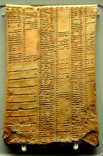
Cuneiform Synonyms List
In 627 CE the area was the site of the Battle of Nineveh, the decisive Byzantine victory in the Byzantine- Sassanid War (602-628 CE). This engagement brought the region under Byzantine control until the Muslim conquest of 637 CE. While other great cities of ancient Mesopotamia were recognizable from their ruins, of Nineveh there was not a trace. The city was best known through the Christian era (and still is) by the central role it plays in the Hebrew composition known in the Bible as The Book of Jonah. The Book of Jonah was written between 500-400 BCE depicting events from hundreds of years earlier in the reign of the Hebrew King Jeroboam II (786-746 BCE). While, in The Book of Jonah, the city is spared the wrath of God, other references to Nineveh in the Bible (The Books of Nahum and Zephania, among them) predict the destruction of the city by God's will (though it is certain that these works were written after the city had already fallen and the `prediction' is, therefore, simply re-worked history). The Book of Tobit takes place in Nineveh and the Gospels of Matthew (12:41) and Luke (11:32) both make mention of the city. As with Babylon, Nineveh is never mentioned favorably in the biblical narratives and, as the focus of those writers was on the story of the god of the Hebrews, no mention is ever made of the cultural and intellectual heights to which Nineveh rose in its prime. In fact, in the Book of Nahum 3:7, the writer states that Nineveh has fallen and asks, rhetorically, who will mourn for her. The full verse reads, "And it shall come to pass, that all they that look upon thee shall flee from thee, and say, Nineveh is laid waste: who will bemoan her? Whence shall I seek comforters for thee?" Although the writers of the biblical narratives may have thought poorly of the city, it was among the greatest intellectual and cultural centers of its time and there were no doubt many who mourned the city's destruction.
The ruins lay buried until they were uncovered and excavated by Austin Henry Layard in 1846 and 1847 CE. Further work by Campbell Thompson and George Smith, among others up to the present day, has revealed the magnificent scope of this once great city. The site is known today by the two mounds which cover it: the Kuyunjik and the Nebi Yunus. The Kuyunjik mound has been excavated and all major finds come from this area. The Nebi Yunus mound (whose name means `Prophet Jonah') remains untouched owing to an Islamic shrine to the prophet and a cemetery built there. In the 1990's CE the site was vandalized and a number of well preserved panels broken and stolen which later appeared for sale on the antiquities market.
Today Nineveh is in danger of encroaching urban sprawl from the suburbs of Mosul and has been damaged by further acts of vandalism. In 2010, Global Heritage Fund listed the ruins among its Top Twelve endangered sites for these reasons among others. Once, however, the city was among the greatest of Mesopotamia, home to the goddess Ishtar, and there is no doubt that Sennacherib, and the kings who built before and after him, believed that the glory of Nineveh would last forever.
MAP
LICENSE:
Article based on information obtained from these sources:with permission from the Website Ancient History Encyclopedia
Content is available under License Creative Commons: Attribution-NonCommercial-ShareAlike 3.0 Unported. CC-BY-NC-SA License