What types of maps are there?
Map types
What types of maps are there?
Maps are concerned with graphically representing the territory to provide guiding information on aspects such as location, limits, geographical features, etc. We registered a total of 17 types of maps that we have grouped as follows:
- Maps according to the territorial amplitude;
- geographic maps;
- maps that record human intervention in geographic space.
Let's know what they consist of and what their main characteristics are.
Types of maps according to the territorial amplitude
When talking about types of maps according to the territorial extent, we refer to the basic shapes of the maps, which serve as the basis for different uses. Let's see.
Planisphere or world map
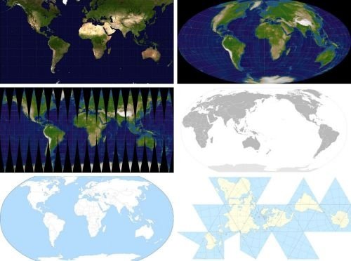
First strip: Mercator projection and Hammer-Aitov projection. Second strip: Mercator projection with meridian bands of 20 ° and projection centered on the Pacific Ocean. Third strip: projection centered on the Atlantic Ocean and Fuller projection or Dymaxion map.
Mapamundi literally means map of the world. Its essential characteristic is to provide information on the general geography of the entire planet Earth, including territorial platforms and the oceans.
World maps often distort Earth's proportions because of the difficulties of representing the roundness of the Earth on a two-dimensional surface. For this reason, over the years, cartographers have proposed various ways of solving this problem, which has given rise to the so-called planispheres.
Models that represent both hemispheres of the Earth in a single plane and that claim to respect the proportions of the Earth's surface according to the meridians are called planisphere .
Continental map
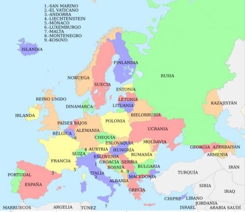 Europe continental map
Continental maps are characterized by representing a specific continent. These can offer information about its conformation, limits or any other element that you want to highlight.
Types of geographic maps
Geographical maps are those that provide specific information on the physical characteristics of the territory, be it land or marine platform. That is, its center of interest is in geography itself, regardless of human activity.
Physical map
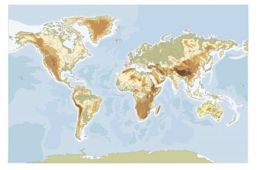
Physical maps are characterized by not attending to the separations between borders, since their main objective is to map the land relief, geological formations or any alteration of the Earth's surface. They record, for example, the presence of mountain ranges, valleys or volcanoes.
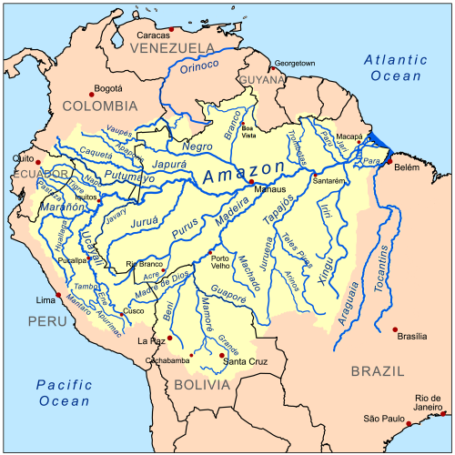
The main characteristic of hydrographic maps is the representation of all the water sources in a certain area. They include seas, rivers, lakes, waterfalls, basins, wells, etc.
Bathymetric map
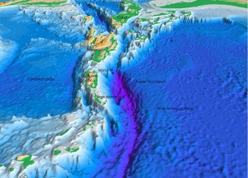 Barimetric map of the vicinity of the Puerto Rico trench
The barimetric map is related to the hydrographic map. However, instead of recording the water channels at the surface level, it is characterized by studying those accidents that are found in the depths. In other words, this type of map represents the underwater depth, and its reference point is sea level.
Orthophotomap
It refers to the maps that are built from an orthorectified aerial photograph, which is made with a photogrammetric camera that allows the real scale of the photographed terrain to be recorded and corrected, avoiding distortions of the camera angle. They are usually taken from an airplane and, currently, with the help of drones.
Topographic map
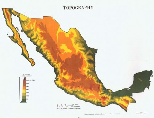 Topographic map of Mexico
Topographic maps are those that are devoted to the representation of the earth's surface. Although in this sense they resemble physical maps, topographic maps are specialized and characterized by giving rigorously detailed information on the topography of the mapped region.
Geological map
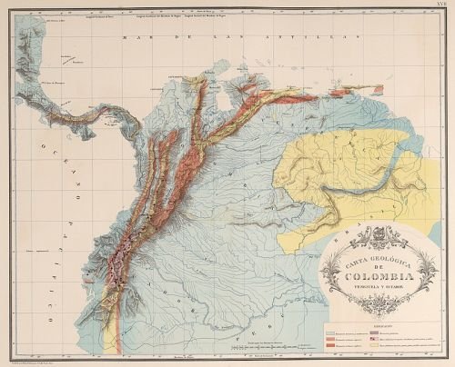 Geological map of the Andean zone
The geological chart or geological map focuses on the representation of the soil and the subsoil of the mapped area. It takes into account the representation of rocks and geological formations, their age and the transformations suffered over time. For example, these types of maps usually visualize seismic faults.
Edaphological map
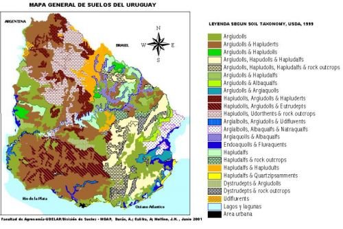 Edaphological map with soil types in Uruguay, 2001
It is a type of map that provides specialized information on soil types, their biological, chemical and physical attributes, as well as limitations. This type of map allows the identification of possible processes such as desertification or pollution, among others. It takes as a reference the world base of the soil resource of the Food and Agriculture Organization of the United Nations (FAO).
Climate map
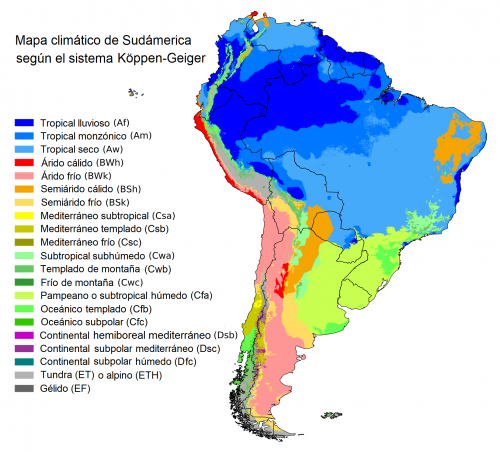
Climate maps are those that are devoted to representing the behavior of the climate in the study area: indicators of temperature, humidity, orientation of the winds, etc. It can even include signs representing the flora and fauna of the place when necessary.
Pluviometric map
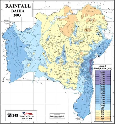
The pluviometric maps represent the rainfall in the area, that is, they graphically record the behavior of rainfall, its frequency and characteristics.
Map types according to human activity
There is a type of map that, based on basic cartography, whether global, regional or local, allows a record of human activity within the geographic space. This type of map has as its center of interest the understanding of political, economic and social phenomena in relation to space. Let's see some of them.
Political map
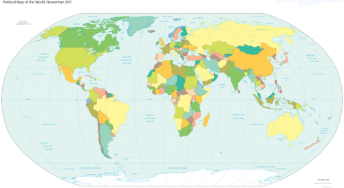 World political map
Political maps are those whose function is to represent the territorial limits between regions that constitute a political or administrative unit, whether they are borders between countries, states, regions or municipalities.
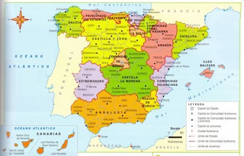 Political map of Spain
In other words, political maps are those that express how the territorial administration and its limits are distributed. For this reason, the essential characteristic of the political map is the graphic representation of the territorial borders . Borders are imaginary lines established by human beings to delimit the administration of a territory.
Demographic map
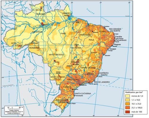 Demographic map of Brazil
Demographic maps show the concentration or density of the population within a given territory. This allows obtaining information on how the rural and urban population is distributed, where the largest population is concentrated, etc.
Linguistic map
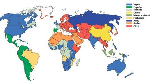 World linguistic map
They can be thought of as a subcategory of demographic maps. Linguistic maps provide information on the use of languages or accents within the framework of a territory.
Economic map
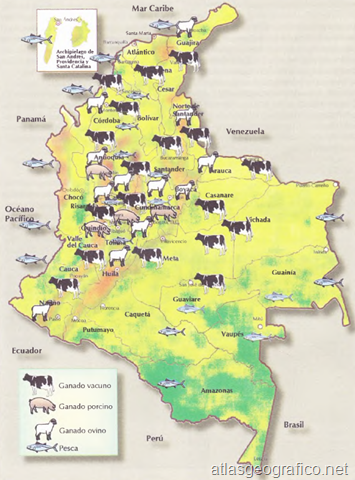 Livestock map of Colombia
Economic maps are those that give an account of the economic activities of a certain region. The economic maps linked to the exploitation of the earth's resources are particularly important, that is, oriented towards obtaining raw materials or diverse resources.
Historical map
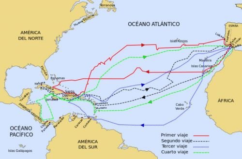 Historical map of Columbus's voyages to America
Historical maps are those that depict events from the past to help the investigator orient himself. They are very useful to understand historical phenomena such as migrations, the history of economic routes, invasion processes, the expansion of historical actors, etc.
Urban map
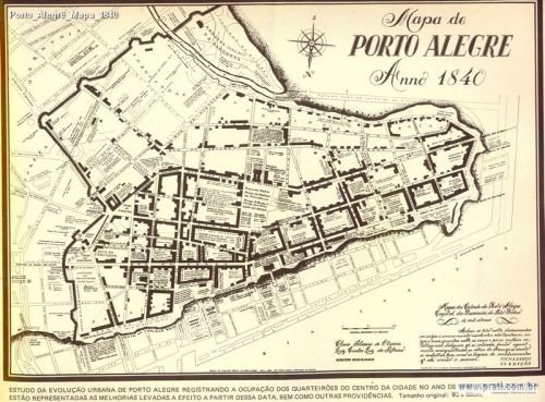
Urban maps are those that provide graphic information about the design of the city. You can include many items depending on your role. For example:
- map of the main routes (roads and transport networks),
- administrative divition,
- points of tourist interest,
- points of general public interest (hospitals, government entities, schools, firefighters, etc.).